The fishy tale of Fish Island
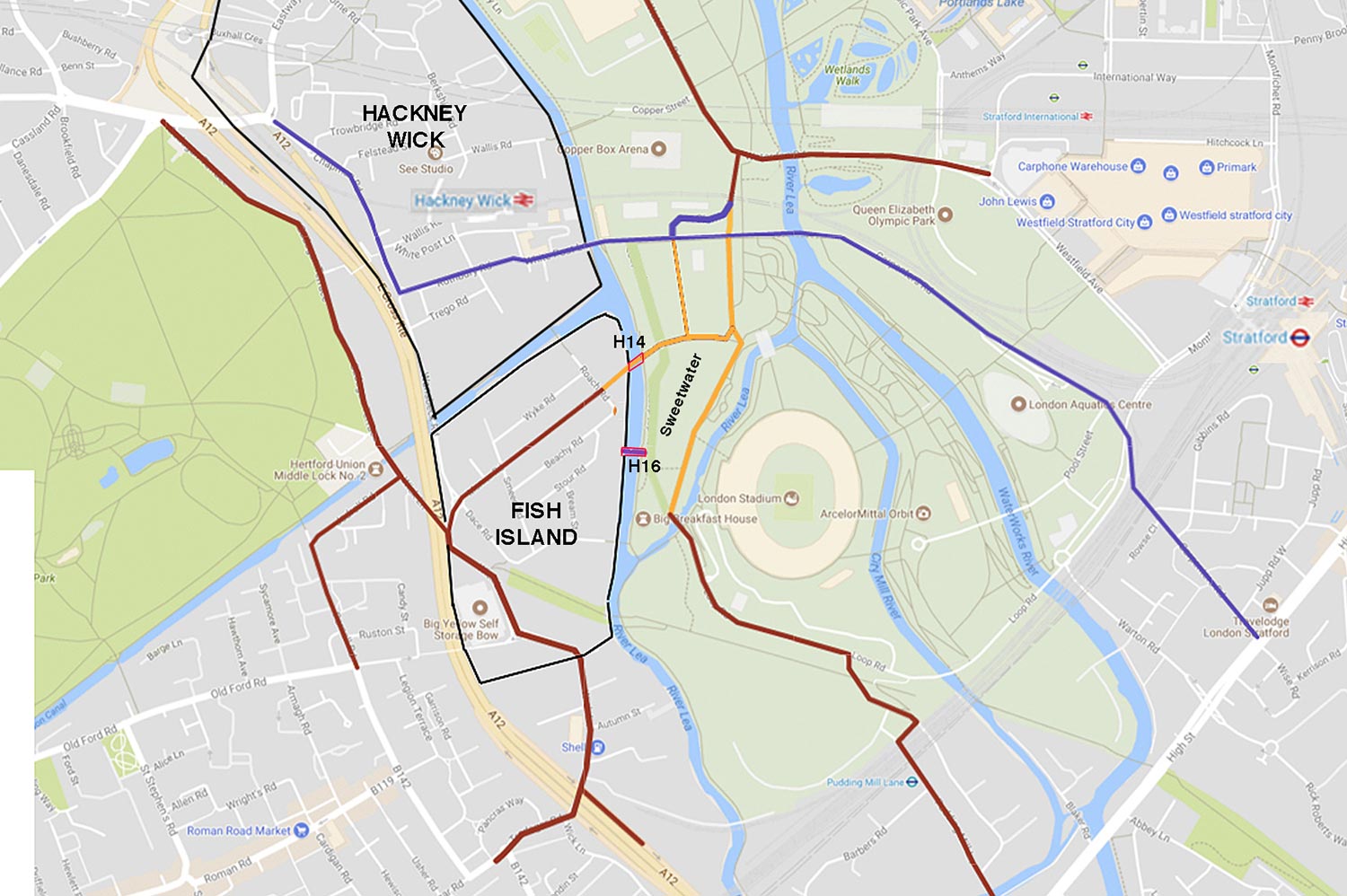
A testimony to its industrial roots, Bow is criss-crossed by rivers, cuts, canals, railways and roads, and right in the middle is Fish Island. Separated from the rest of Bow by the A12, Fish Island nevertheless still falls in the ward of Bow East and shares the E3 postcode. With your help, we’ve uncovered the rich history of the Island, from marsh to workers’ town, from industrial estate to artists’ haven.
First of all, Fish Island is not really an island. The 50-acre plot of land is in the shape of an isosceles triangle with water on two sides. The Hertford Union Canal forms the north border, the River Lea runs along the length, and the A12 on the third side.
Hackney Wick, on the other hand, is north of the canal and sits in the elbow of the A12.
How Fish Island was formed
Fish Island stands where a ford used to be. It was the main crossing point between London and Essex until the early 12th century, when a stone bridge was built half a mile downstream. The bridge was in the shape of a bow, eventually naming the place.
The first settlement recorded at the Fish Island was Old Ford, which can be traced back to the 13th century.
The village was surrounded by a marshy floodplain, carved through with canals in the late 18th and early 19th century. The Hertford Union was built in 1830, forming the Island’s northern border, and a railway built shortly after, making its western one.
At around the same time, the Old Ford Marsh was drained, creating more land to build on. Fish Island was fully formed.
In 1865, the Imperial Gas Light and Coke Company bought 30-acres of Fish Island to build a new works, but ultimately decided to put their factory in Bromley-by-Bow. The company instead developed the land into a factory town, filling the streets with workers’ houses and smaller factories.
And Dickens wasn’t wrong about the East End. Fish Island became known for its poverty and its poorly built temporary housing, a corner of Victorian London reserved for the working classes.
It was around this time that Fish Island became Fish Island. Originally known just as ‘the Island’, it picked up its scaley nickname from its streets, which were all named after freshwater fish: Bream Street, Roach Road, Dace Road. Listen to the Idea Store’s podcasts about Fish Island for some more wonderful stories.
Fish Island’s industrial past
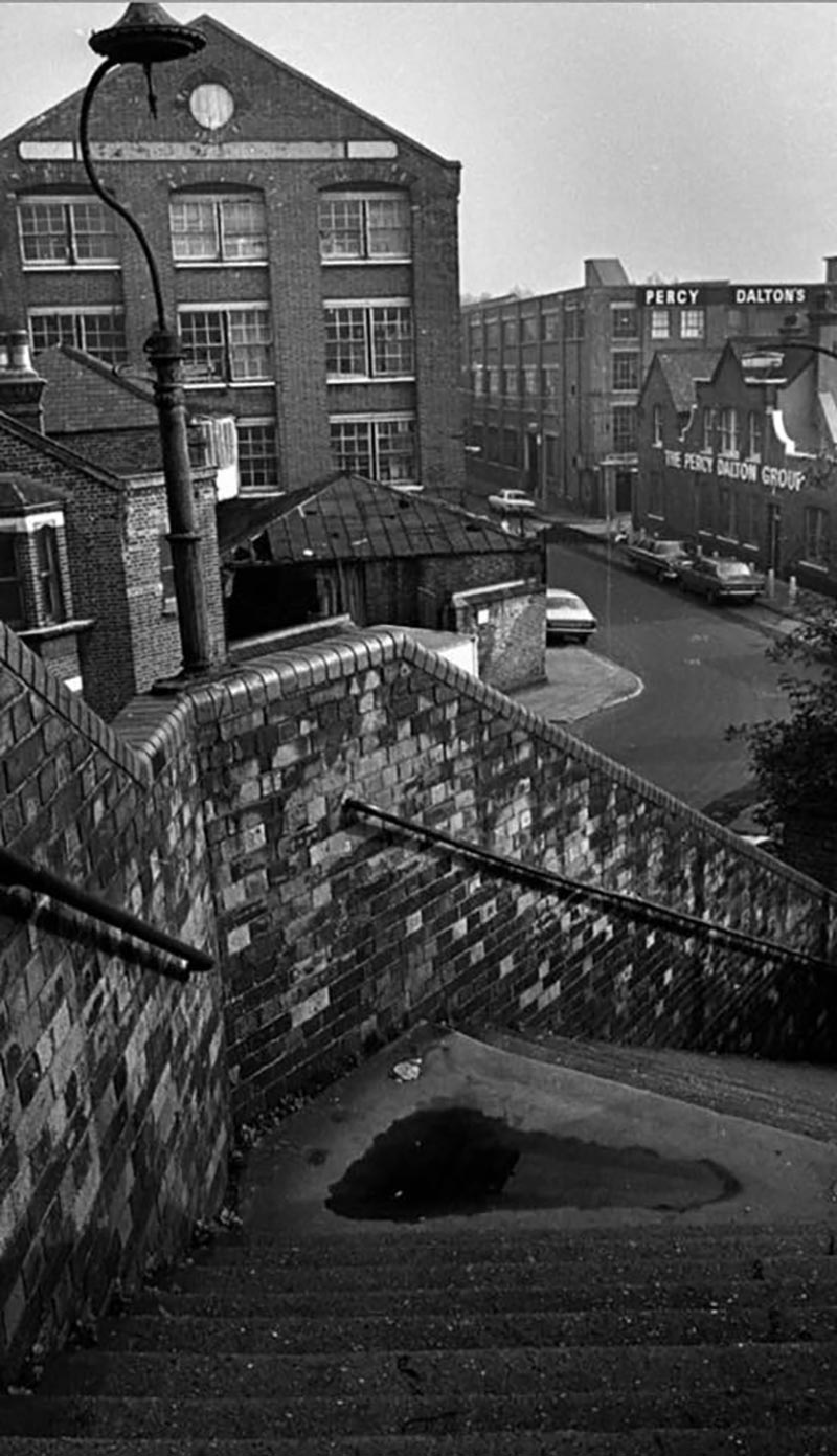
By the beginning of the 20th century, Old Ford was an area of hustling and bustling, smokey and sooty industry.
Raw imported materials, such as crude oil, rubber and sugar, would travel into London down the Thames, up the canals, through the locks and into the East End. Once they got to Fish Island, they were turned into products and sold throughout England.
From 1907 to 1924, one of the factories housed a printing works, specialising in bank notes and postage stamps. There was a glue factory, pickle factory and peanut company, and along the canal stood timber yards and furniture workshops.
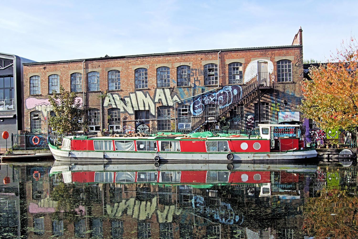
The six buildings in the northern part of Fish Island make up what is London’s, and possibly England’s, largest group of surviving industrial buildings with transitional structures (built at the turn of the century when architects were transitioning from designing iron-framed buildings to steel-framed ones).
But Fish Island was badly bombed in the Second World War. By 1960, housing areas had been replaced by warehouses, making the area purely industrial.
By the 1990s, most factories on the Island were used for waste disposal and recycling.
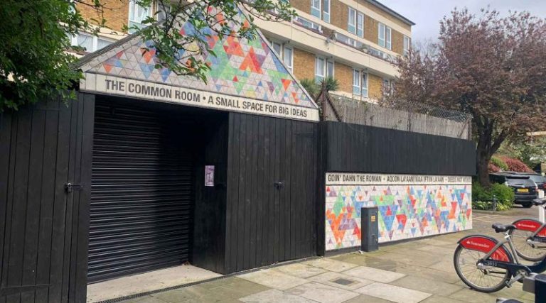
Home of artists and innovation
As industry moved out of Fish Island, the artists moved in. In the 90s it had the highest density of artists’ studios in Europe. Out of the 750 studios, one was owned Op Art legend, Bridget Riley.
After artists began to be priced out of Fish Island, a partnership was set up in 2014 between tech hub, The Trampery, and the Barbican Centre, called Fish Island Labs. The project allows for between 40 and 50 people to share low-cost workspace for ten months.
Slowly, warehouses turned from factories to studios to living space.
In April, Hackney Wick and Fish Island Creative Quarter, home to nearly 250 artist studios and more than 100 creative businesses, was awarded a £50,000 grant from the Mayor of London in order to help make it a Creative Enterprise Zone. The scheme ensures artists aren’t priced out.
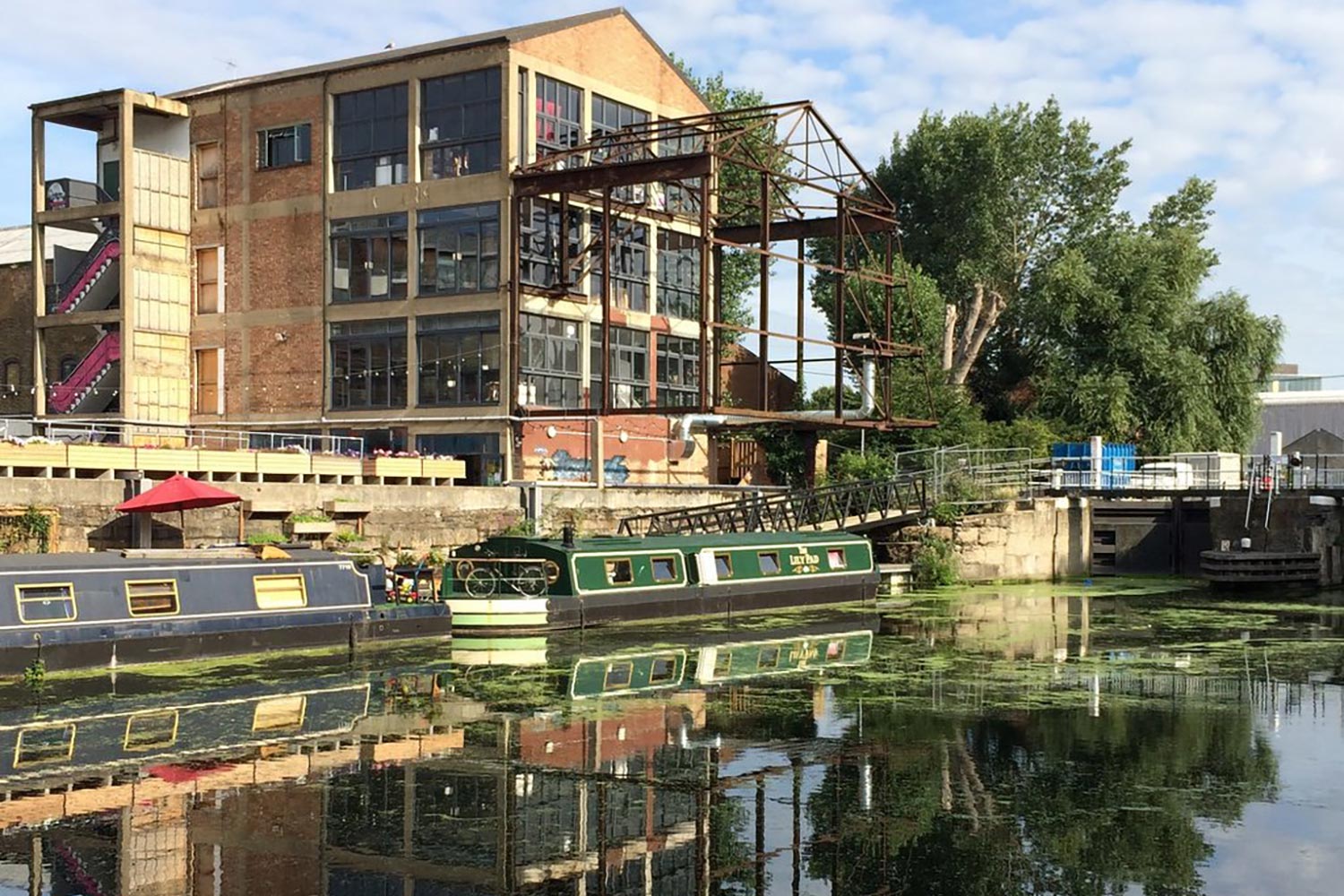
Also on the Island is Stour Space, a community hub with coffee shop, gallery and studio space, and Truman’s Brewery. Another long standing member of the community is H Forman & Son, a fish smoker who have been based in the East End for over a hundred years.
The legacy of the Olympics and the battle to keep Swan Warf
In 2005, Roach Point pedestrian and cycle bridge was built across the Hertford Union canal, halving the journey time from Fish Island to Hackney Wick station, and paving the way for more residential buildings on the Island.
The same year, London won the bid to host the Olympics, increasing the amount of development in the area and boosting the house prices.
In 2014, planning permission was granted for 580 homes and 3,000m2 of commercial space at Neptune Wharf, Fish Island. Now, there are more than 4,500 being built in Fish Island and Hackney Wick.
In 2008, Swan Wharf was included in the Fish Island Conservation Area by Tower Hamlets Council. The stable block there was built between 1906 and 1912, but was earmarked to be demolished in 2016.
After thousands of signatures, the building and the yard below was preserved and allowed instead to be used for creative purposes.
Now at Swan Wharf is a 500-person outdoor venue with jazz performances, DJs, World Cup matches, food and drinks, as well as space for artists and creatives.
With special thanks to Ted Murphy for the photographs.
If you liked this, why not see our gallery of old maps of the area.
If you enjoyed reading this fishy tale, you might enjoy reading about Roman Road’s Del Downey, from the oldest fishmonger family in the East End.


Your local news is at risk

How interesting. I lived in Monier Road until 1967. My Father and Grandmother had lived there all their lives until we were moved out for the new motorway to be built, practically on top of were our three roomed maisonettes stood. Numbers 7 and 13. Before my Nan married and lived down the bottom end of Monier Road with her parents, brother and four sisters. Her maiden name was Dalton. Married name Goldberg. We might have lived in poor accommodation on reflection, however we all loved it there. Especially all living so close. I had a wonderful loving relationship with my darling Nan, aunts and uncle. Thanks for the memories. Marion Kelleher, nee Goldberg. X
Hallo Marion My Name Is Ed (Ted ) Rudling My Dad Had The Oil Shop Near The Bridge In Wick Lane. 50,s 70,s I Went To Fordway Primary School .I Remember some Names from Monier Rd Like Alan Gargano Michael Attwood. Billy Mossom. David Harman. Harry Cook. Terry Mann. Shops Ralphs, Off License, Bakers . Hope This Is Your Era.
I lived 5 monie rd from 1944 to 1952 ,iwas friends with Michael Attwood no relation Grandparents and Aunt and cousins lived in Dace Rd Angus Family, we move to Ranwell close old ford Rd.
Hi Marion so lovely to read this. I lived at 154 Monier Road from 1952 until around 1965 when my dad bought a house in Redbridge. Our surname was Hill. My mum’s family of 7 were born on Fish Island and their family name was Barker. I too went to Fordway Primary and then on to Laureston road (South Hackney School). I too have lovely memories of playing on the “bars” and going to Reggies sweet shop and Victoria park
Unfortunately Swan Wharf is once again under threat. Anderson Group & Constable Homes have submitted yet another planning application – they still want to tack additional storeys on top of the stable block and obscure it by erecting another two buildings covering most of the goods yard. Objections can be made online, planning application 18/00315/FUL at https://planningregister.londonlegacy.co.uk/swift/apas/run/wphappcriteria.display
Hi all, I have just found this amazing site!! I am looking for any information on John William Gardner who married Susan Harriet and they lived in monier road and bream street. His father was John Charles Gardner. He died after falling down the cellar in the Gunmakers Arms. Any info would be very much appreciated.
The name ‘fish island’ was not used until very recent years. It was not known as fish island in my lifetime living in Monier Road.
That’s very true. It is now a marketing ploy to sell all the flats that are being thrown up. There was a murder in Wyke Road in the late fifties/early sixties that went to court (I think Old Bailey) and the judge referred to it as “Devil’s Island” and that was the banner headline in the Mirror. “The Island” is now (for the same commercial reasons) often referred to and/or coupled with Hackney Wick. It is not in Hackney. Hackney starts in Wallis Road and I think (I’m not completely sure) that Hackney Wick overground station is in Tower Hamlets.
I was born in Old Ford and my Mum always used to say ‘down the Dace’ for that area where we had family members.
I’m looking to find some information on Smeed Road, my family lived down here and can’t find anything really about it. The ‘Stump’ family.
I too would be really interested to hear some information on Smeed Road. Does anyone know how and when the street came to get its name.
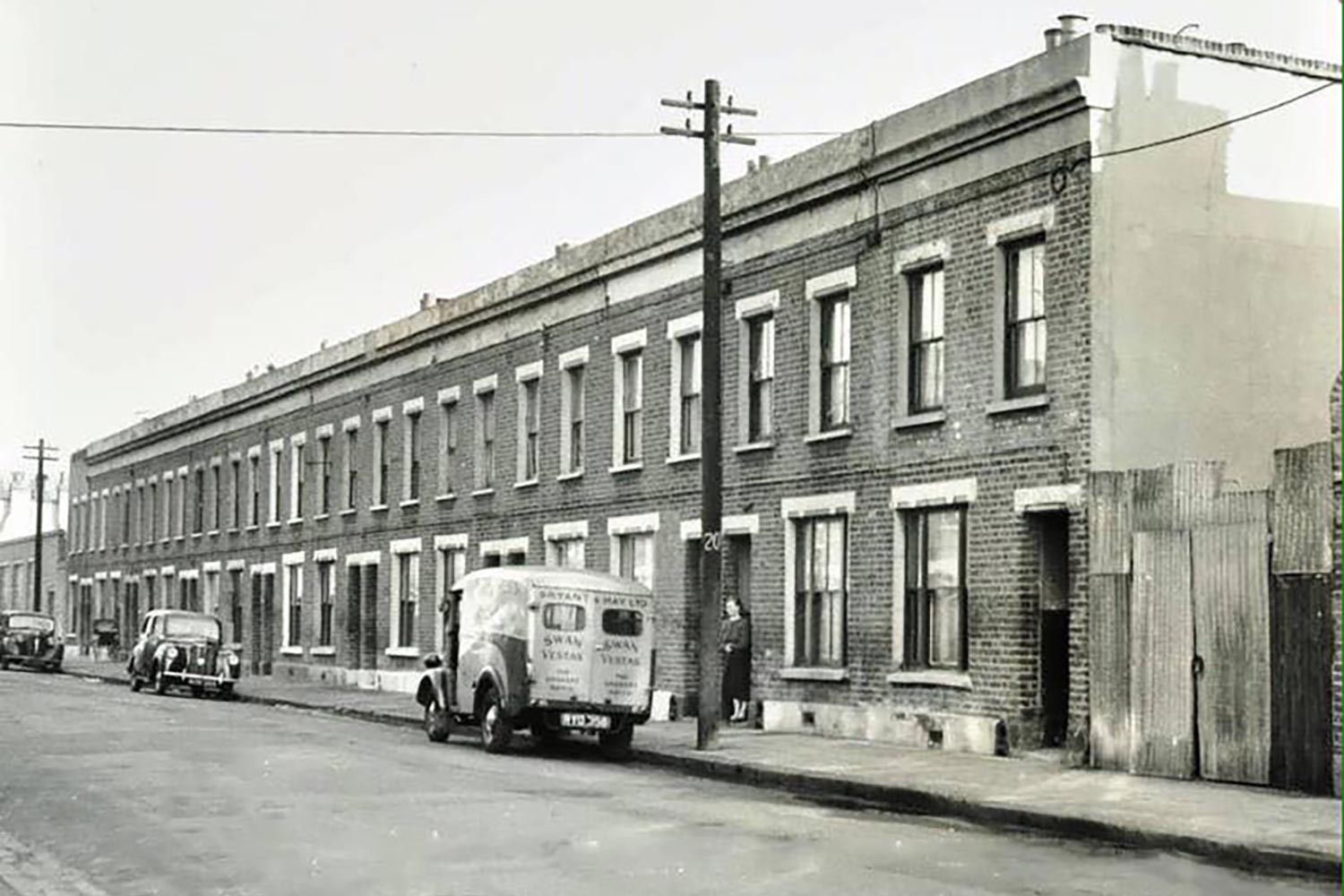
It says above that the housing had gone by 1960. That’s not correct. Certainly most of the Bream Street and Dace Road housing was there in 1970. There were then a number of very unpleasant abattoirs in Smeed Road, Monier Road and Beachy Road and for a while there was a slaughterhouse on the corner of Dace Road and Monier Road.
There was a small road that ran parallel to Monier Road with Rudlings Oil shop on the corner. What was that road called? In more recent times the road that ran between Wyke Road and the cut between the River Lee and the Regents Canal was also flattened. What was that called?
John Vogler resident in Bream Street until 1970
yes I agree, we lived in Wyke Road, my sister was born in 1961 and I was born in 1964. We moved in about 1965 so house was still standing then.
Hi my family lived in bream street surname SAMES
My family lived in Bream street name savill
Hi Wayne, my Dad’s family lived in Stour Road on the Island; the Diable family and Sames was the surname of my Dad’s mum. They lived there for years. We’re probably related!
John –– just been reading your comments: I have no historical connection to the area, but I am fascinated by the history of the Island. We’ve had a printing and bookbinding studio on Dace Road, part of what was Percy Dalton’s Britannia Works, and have been here since 2012. Even in the time we’ve been here, it’s changed so much. Do you ever get a chance to visit? I don’t imagine you’d recognise it!
Hi my nan Ethel lived at no 20 Bream Street, just wondered if you remembered her
In response to part of my own question, the road that ran parallel to Wyke Road was called Rippoth Road. Perhaps an appropriate name in relation to the expensive flats now in that area. Still searching for the name of the the small road that ran parallel to Monier Road.
I also recall that whist the sewer embankment is now called “The Greenway”, it used to be called “The Prom”. Apparently the local authority (which one?) called it “The Promenade” but the locals shortened the name
I think I have again answered my own question. The road that ran parallel to Monier Road was Remus Road. That road was L shaped (as was Rippoth Road) with one end opening into Monier Road. That end of Remus Road still exists and now has flats there referred to as “The Old Smokehouse.”
I took a trip to the Tower Hamlets Archives (in Bancroft Road) they were very helpful and I now have copies of photos taken of Monier, Remus and Rippoth Roads. These photos have a copyright so I cannot post them on this site.
My family used th live down Rippoth Road from the turn of the century, until it was demolished. The Banks and the Sweetman families. I have been researching the 1911 census and found that each house had between 2 and 9 people living in them. I remember my grandad taking me through someone’s house to access the canal for fishing. Happy days.
My family lived in Rippoth Road, in different houses, lastly number 29. My Nan was Sylvia Nunn, and she delivered many babies in the road. She lived with my Aunt Nell Chaplin. At number 44 loved my aunt Lil and uncle Tom Baker. We lived in Stratford and a visit to nans was always called going “ over home”. Many really happy memories, waiting for the 208 just inside the doors of the Mitford, while dad grabbed a quick pint. The Offy on the corner of Rippoth Road. Fishing in the cut from nans back garden. Never heard it called Fish Island though.
I also had family at no30 I found out last night
My mother’s family lived in Atley Road. They were the Goldings and Davis’s. I am trying to find out more about their history can anyone help?
Hello,
I wonder if anyone knows what the horses stabled at Swan Wharf were used for? I know the rubber works were steampowered so I’m guessing for haulage, but wondered if they were like ‘inhouse’ transport for the factory or just a carting agent?
Many thanks, Shannon
In 1961 I had my first kiss on a street on Devil’s Island as it was then known. The girl’s name was Linda Jenkins who had three older brothers – they all lived on Devil’s Island. Her older brother, Cliff, was a London black cab driver.
My grandparents and family, including my mother , lived in Monier Road from 1910-1941. My mother (born 1900)and siblings were born in Wyke Road from 1899-1909, They lived at the ‘bottom’ end of Monier Road near Roach Road, no. 151. We lived further south nearer to Bow Road but I can clearly remember visiting my grandparents and the tall Youngers chimney (pre- WW2). Stopping off to go to Victoria Park on the way.
Hi Iris, I just noticed your comment and am wondering if your family might have known my great uncle called Bill Sykes who lived at number 101 Monier from 1930. He was born in 1896.
Might be a long shot but would be fascinated to hear if there was any connection.
Hi Gina. I seem to remember my mum and uncle talking about Bill Sykes. They were Vicky and Alf Johnson and lived at 40 Beachy Road from the 20s to the 50s. My dad was Frank Scaysbrook from 13 Remus Road. He was one of 12.
Hi Wayne, I lived at 154 Monier Rd. I knew Helen Sames. She was loverly and got me my first job as a junior Secretary when I left school. We both worked at Armough Wharf, in Armough Rd near Roman Rd. Inwonder if she still remembers me. We were the Hill family. Best wishes x
Hi everyone, I lived at 50 Wyke Road shorty after I was born in 1955. My Dad was still in the army so my Mum, her sister and my Nan all lived there for a while. My Nan passed away in 1968 and I believe my aunt was rehoused in a tower block in Driffield Road in about 1970 before Wyke Road was demolished. I also went to Fordway school from around 1960.
I believe the archive photograph of Wyke Road featured was my Nan’s dwelling. The reason I say that is the no longer standing house to it’s left was used as a builders yard as it suffered bomb damage during the war.
Fascinating stuff and some fond memories from those times.
Graham Miller – former Wyke Road resident.
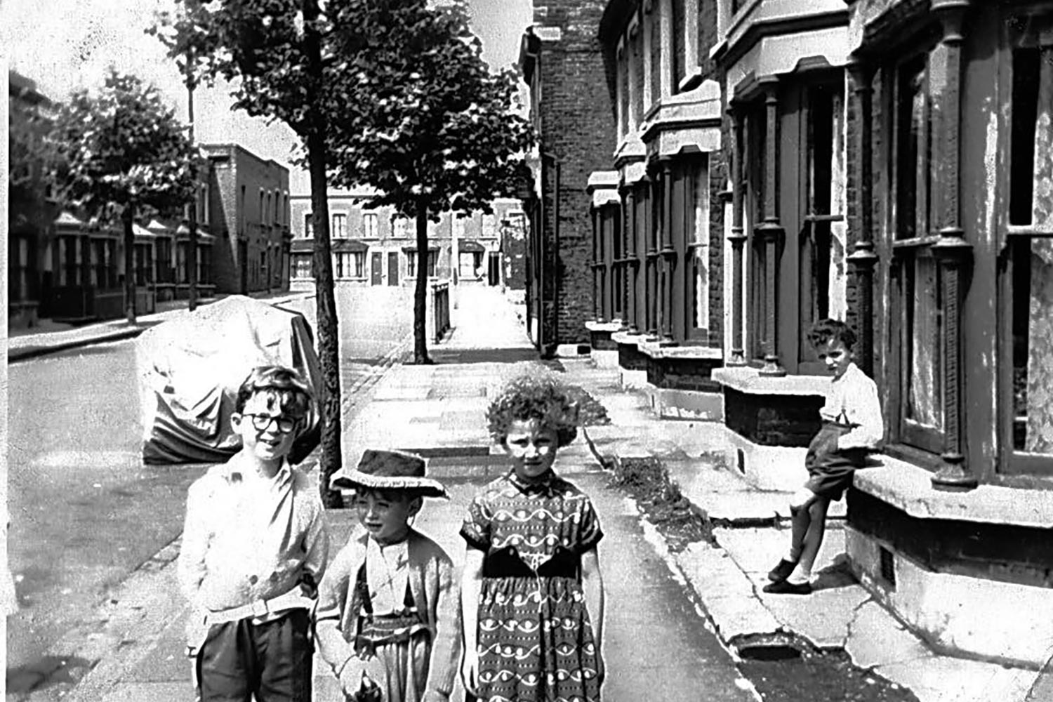
I am the young boy in the cowboy outfit in the photo at the top of the page.
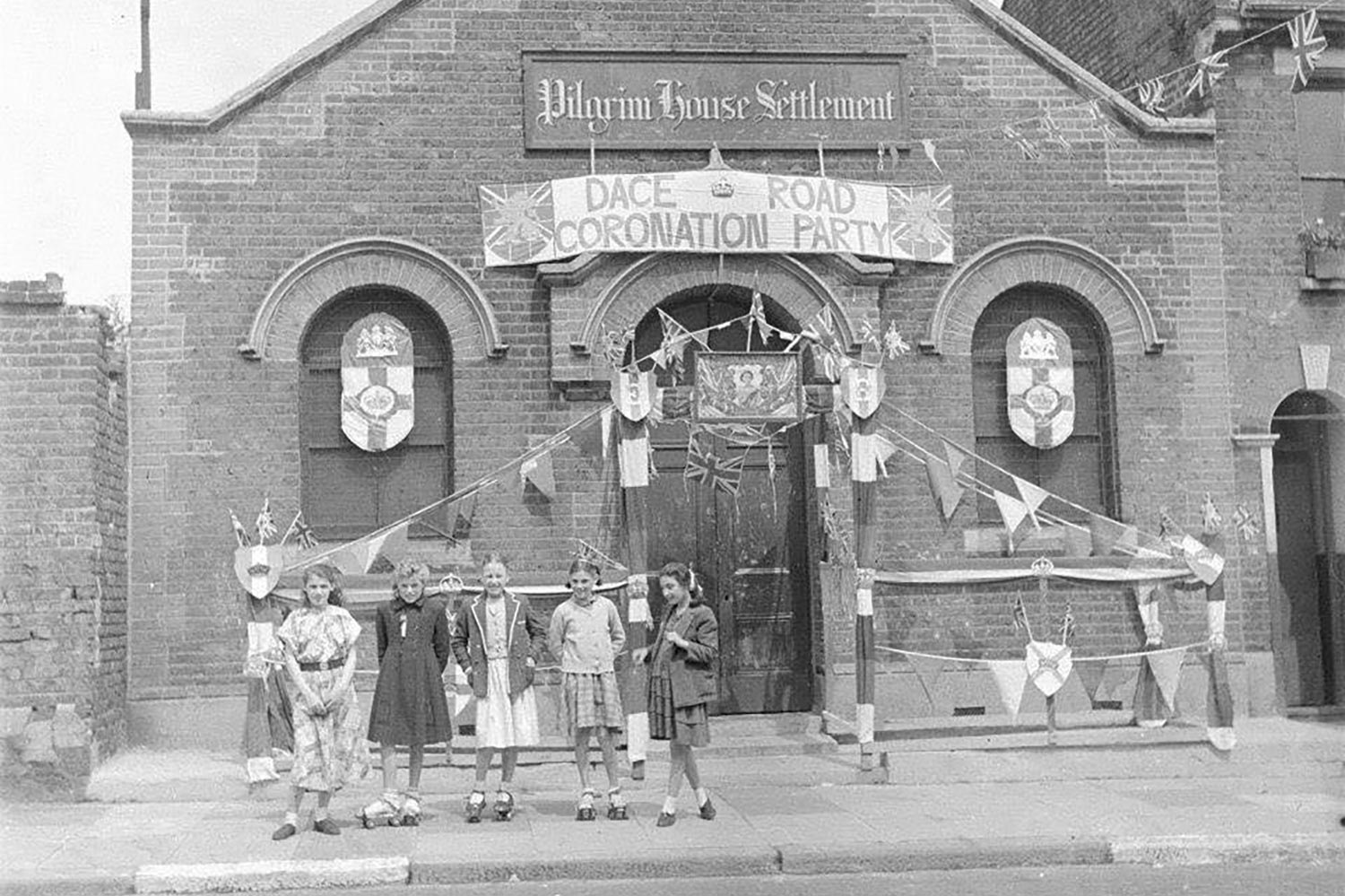
hi, R. I am Paul and lived next to Pilgrim House, Remember Dennis, Chris, John who lived next to Georges shop? and many others.
Hi. I just found this site and all the pictures are bringing back lots of memories of the Wick. I was born on Brookfield Rd in the late 70’s and grew up on the old Trowbridge estate and Wick Rd post it’s demolition. My mum Maureen was a part time barmaid at the Tiger pub through the 70’s (during the Gloria and Tony years). My grandmother and her both worked at the London Chest Hospital from the late 60’s onward. Mum was also very involved in the jumble scene and Albion Kid’s Show. We moved away in the mid 90’s to North Hackney. I returned just before the start of the pandemic. Am so shocked at how much it’s changed. I’m still exploring but feel that a lot of it’s heart has been gutted out, these pictures bring back such nice memories. We had so much fun as kids roaming out from Trowbridge all the way to the Bow Bells and Stratford. The old 276 route was basically our giant adventure play area 🙂
We lived at 23 Dace road, with my Grandparents thier name was Hales. My other grandfather was George Young. He was landlord of the Mitford Castle pub, from 1944 to 1957. He later ran the Iceland pub on Old Ford road. Bob
Shannon, the horses were used for pulling the barges along the canal before the tug boats took over.
Hello, I’m looking into my family history and it seems my great grandparents lived in Monier Road also Wyke Road. Their name was Sheppard. Does anyone know anything more about the murder in the 1950’s that is mentioned in one of the comments above please?
Hello my Nan used to live in 2 Wyke Road. I remembe4 going there with my dad in the mid 1960s. I was only about 5. My nana name was Ada Rose Pritchard she lived there with her three young sons. Jimmy, Peter and Paul.
I used to be frightened going there as the house was very dark with creaking stairs… at the top of the stairs on the landing was a cooker and just two rooms. There was a small yard and my Uncle Jim had pigeons out there….. distant memories. Does anyone remember my Nan?
Can anyone tell me the location of Cundalls Cartons maybe in Dace Rd or Smeed and Boxes Ltd. Would love to know exact buildings/locations if poss. Also did anyone know the Eason famly
my mum lived at 23 monier road till 1962 we then moved to a new place near the lady franklin .tony marsh